First published on 23 de Mayo de 2017 • Last updated on Febrero 12, 2018
This page may contain affiliate links; if you purchase through them,
we may receive a small commission at no extra cost to you.
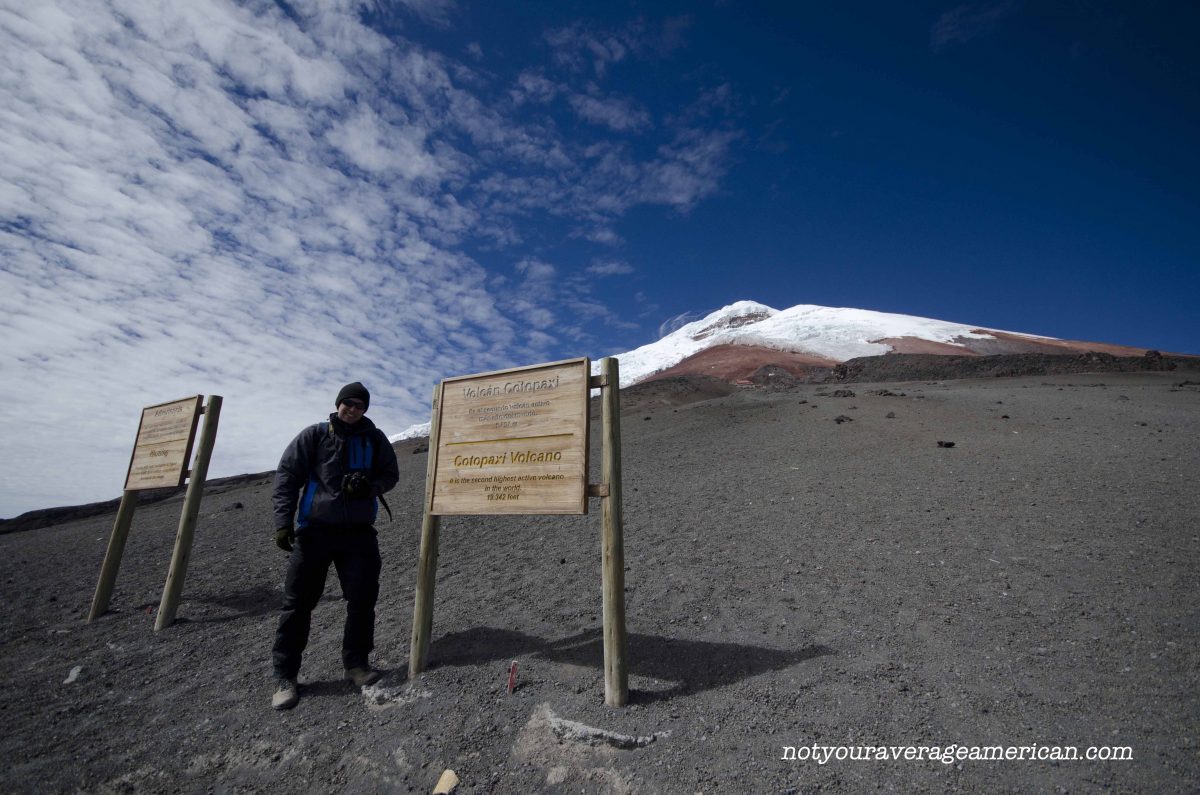
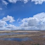
Today, the Refugio is a final destination. On clear days, it makes for a perfect spot to admire the other volcanos in the distance. On overcast days, the hike alone just might be worth it. The terrain is high paramo. There could be snow, ice, or just rocks and ancient volcanic ash.
Your first step is to get to Cotopaxi National Park. It’s about an hour and fifteen minute drive from downtown Quito to the main park entrance, all signed from the highway. Once in the park, it’s about another hour to drive to the parking lot where the trailhead starts. And that’s without stopping much for photos! On a clear day, it’s hard not to take the time to just stop and enjoy the views. But if you’re hoping to beat the afternoon layer of clouds, which are unpredictable at best, then drive on!
Once you reach the parking lot, you’ll be rewarded with unbelievable views of both the mountains surrounding Cotopaxi and of the volcano itself. That is, if you arrived on a clear day.


Our first visit, we were welcomed by layer after layer of cloud. Or fog. It has become a long-running family debate on what to call the dense vapor that quickly envelopes the high mountains of the Andes. We could barely read the signs telling us we had arrived at our destination much less see a trail.
If you find weather like this, you might get lucky and hike up through the cloud layer. But be sure you know where you’re going. This is a mountain after all and it comes with a set of dangers that many people don’t seem to respect. We have watched hikers struggle with symptoms of high altitude sickness, like euphoria (acting drunk) and splitting headaches, their guides oblivious to the dangers of remaining on the mountain.
Most people who come to hike to the Refugio head to a trail that goes straight up the gut. It’s steep. It’s pea gravel and some ash, for the most part. The trail is part open tunnel, with tall sides and no rooftop, which you might think would protect you from the wind. At times, it actually serves as a funnel as the wind comes straight down the mountain and smack into your face as you hike up or pushes you forward at an ungainly pace as you hike down.
The Switch Back Trail
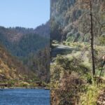
Our recommendation is to take a trail that starts on the far left of the parking lot and leads you through a set of switchbacks. The switchback route took us one hour and it allowed us excellent views of Antisana and the other mountain peaks to the north of Cotopaxi. The switchback trail is in much better shape than the well-used main trail and while it looks like it appears longer, it’s much easier on both the legs and the lungs. Take it!

A Few More Suggestions
We have a few other suggestions to help make sure you have a perfect day:
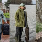
- Wear appropriate clothing including a warm hat, gloves, scarf, as well as the expected fleece and wind layers both top and bottom. You can manage without on some days but weather changes rapidly and temperatures can drop at an amazing rate. Better to be prepared.
- Wear hiking boots. You will see lots of people in tennis shoes. Going up is manageable but coming down is more complicated and the traction you get from a hiking boot or even good quality cross-country running shoe is essential to staying upright. We saw lots of people land on their butts on their way down. If you don’t have a choice of footwear, consider coming down the switchback trail which is much less steep.
- Bring plenty of water. You’re hiking at altitude and, especially in the summer, the winds will whip away the least amount of moisture. Add the equatorial sun and it’s a wicked combination. Proper hydration can help prevent the headaches that come from hiking at altitude. Also, wear sunscreen. Again, that equatorial sun is super strong.
- Bring calorie rich snacks to help with your energy levels. You don’t want a lot of food at altitude but you do want something to help you keep you moving forward. We prefer dried fruits, oil-rich nuts, and a little chocolate (local remedy for altitude sickness).
- Bring a basic first aid kit that includes your favorite headache medication. One of the first signs of altitude sickness is a headache. If you can keep it under control, keep hiking. But if it continues to get worse even with medication, please go back down the mountain. If you are hiking with a friend that exhibits signs of altitude sickness, such as upset stomach, light-headedness, constant stumbling, help them make the decision to turn around. Altitude sickness can make us less likely to make good decisions, not unlike drinking too much alcohol. And no view is worth ruining the rest of your trip, at best, or ending up in the hospital, at worst.
I hope you have as much luck as we did and find the most perfect weather day!
Este post fue publicado originalmente antes de la erupción del Volcán Cotopaxi.
Si bien el Parque Nacional estuvo cerrado por un tiempo, una vez más se reabre y es posible visitar la mayor parte del parque.
Caminatas a la Laguna Limpiopungo, el Refugio y el Pucará Inca están permitidos. El Glaciar y la Cumbre vuelven a estar abiertos. (actualizado el 24 de febrero de 2020)
El Refugio
Desde la entrada principal, siga la carretera principal. Dirígete a la derecha en la intersección que se dirige hacia Tambopaxi y la entrada norte.
Desde la entrada norte, siga la carretera y gire a la izquierda en el cruce.
Limpiopungo
El camino de acceso a Laguna Limpiopungo está justo al lado de la carretera principal que atraviesa el parque. Si ingresa por la Entrada Norte, gire a la derecha en la carretera principal como si se dirigiera a la Entrada Principal del parque, no hacia el Refugio.
Pucará Salitre
El Salitre de Pucará se puede encontrar utilizando carreteras secundarias accesibles desde la entrada norte del Parque Nacional Cotopaxi.
Información para su viaje
Prepárese para el clima frío, incluso en días hermosos. La nieve y la lluvia pueden ocurrir en cualquier momento. Lleve mucha agua y bocadillos de alta energía. Prepárese para dejar de caminar si alguien en su grupo exhibe signos de mal de altura.
- Dirección en auto, use WAZE y busque Refugio Cotopaxi, Cantón Latacunga, Pichincha; para Limpiopungo, busque Laguna de Limpios, Pichincha, Ecuador.
- Dirección en transporte público Desafortunadamente, no hay excelentes opciones de transporte público que permitan llegar, caminar y salir de Cotopaxi el mismo día. Recomendamos alquilar un conductor y un automóvil o pasar la noche en un albergue cercano. Está prohibido acampar mientras el volcán está activo.


