First published on 31 de Mayo de 2017 • Last updated on Mayo 31, 2017
This page may contain affiliate links; if you purchase through them,
we may receive a small commission at no extra cost to you.
About two years ago, I learned that ancient Yumbo petroglyphs could be found along the Rio Chirapi near a waterfall named for the Cock-of-the-Rock, la Cascada Gallo de la Peña, in Pacto. So when I found myself conducting a tourism survey of the area, I added this to my list of must-see places. I first saw the reproductions of the petroglyphs at the small archeology museum in Tulipe. Even the copies are intriguing, circles within circles, finite spirals, and a stick figure human. But seeing ancient art in situ is always preferable to seeing any reproduction.
The Yumbo
The Yumbo people lived in the area around Tulipe and Pacto from around 800 AD until about 1660 AD. In 1660, the Pichincha Volcano erupted and left almost a foot of ash in the valleys around the Tulipe region, making it impossible to farm. The Yumbo left and their time as a people and a culture ended.
The archeology museum at Tulipe protects the most famous remnants of the culture, a set of pools that may have been used for religious ceremonies, ritual bathings, and for tracking the stars. Other ruins are dotted around the area that archeologists call the Sacred Valley of Tulipe in Gualea, Pacto, and Nanegalito. Ruins include tolas, or gravesites, and culuncos, or roads. Most are un-excavated and many are located on private land. If you are interested in reading more about these archeology ruins, look for the book, Tulipe y La Cultura Yumbo in bookstores around Quito or read it here online.

Hiking the Trail
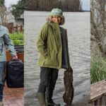
In order to find the petroglyphs on the Rio Chirapi, I highly recommend hiring a local guide. Without Nacho, I would never have found the petroglyphs, even with a well-marked trail all the way to the waterfall.
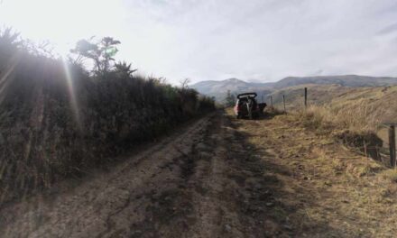
The hike started in the small town of Pacto, where we were staying for the weekend. The trail head was a short walk from the center of town so we didn’t bother to drive. And the parking lot at the trailhead is a work in progress, a muddy pit with a single lane road for access. If one car gets stuck, every car is stuck.
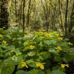
The trail is well marked and, despite a few crushed beer cans and the occasional candy wrapper, it is easy to see that the area is important to the community. A local school has placed wooden signs asking people not to litter and to protect the wildlife. Small trails lead off the main path down to favorite swimming holes. On a hot, sunny weekend, the river is likely full of children splashing around as their parents watch them from shore.

A little ways in, there is a small bridge crossing to a restaurant and beach area, run by Klever Leiva. This is a good opportunity to pick up a bottled water or to use the bathroom before heading further down the trail. It is also an excellent place to have lunch though it was a bit disconcerting to arrive in the middle of «nature» to the thrumming beats of Cumbia and Reggaeton. Enjoying the outdoors means different things to different people and on a weekend in Ecuador, it includes having music at the beach.

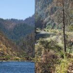
From this point on, the trail meandered through secondary forest. We saw mushrooms and multi-colored lichens clinging to trees, signs that the weather had been damp and rainy. And as we hiked further away from the music, I heard birds in the trees but didn’t see any fly nearby. At some points, the sounds of cicadas were so loud you might have thought they were being amplified by speakers.
The lush green of the forests around Pacto come not just from trees but from huge stands of bamboo. It’s called Caña Guadua and is one of the native bamboos of South America. It can grow up to 30 meters tall… that’s about 65 feet. When the trail crossed the river and we could see downstream, the bamboo fronds arched delicately over the running water while the dense undergrowth prevented almost any light from making it to the forest floor.

We walked past an old orchard of guayabas and Nacho pointed into the trees to an ancient rock wall, a sign of the Yumbo. He said it is another pool, like those in Tulipe, but that the owners of the land do not want it to be excavated. And the landowners might have a point because I was awfully tempted to go over and take a closer look. Having an historic relic in your backyard may not be beneficial if you don’t want to encourage tourism in your community.
The Waterfall
After a little more than an hour of hiking on a fairly flat trail, we reached the entrance to the waterfall. As is common in Ecuador when a natural feature lies on or past private land, there is a gate with an entrance fee. On this day, because we were with a local guide, we weren’t charged. Instead, we got to meet Carmen, the gatekeeper and a fount of information. She answered every question I asked, from what kind of fruit she was selling to pointing my way to the bathroom. And she was anything but camera shy. If you decide to hike this trail and you meet Carmen, please tell her I said hello!


After a bathroom break and a little refreshment, we headed onward!
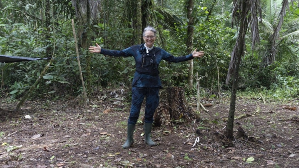
At this point, the trail turned a little trickier. Reaching the waterfall meant a little rock scrambling and some water crossing. I was glad for my rain boots because they helped keep my feet dry but was disappointed that the treads were not ideal for finding purchase on wet granite.
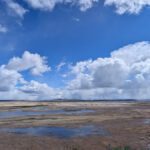
The small waterfall is very pretty; the river falls over a solid ledge of well-worn granite onto an ancient pile of rocks into a pool that looks very inviting. Local lore says that the bright red Cock-of-the-Rock used to nest in this location, in the rock face just above the falls. We didn’t see the Gallo de la Peña though we did see the small black and white bird common to waterways in the Sierra of Ecuador, the White-capped Dipper.


Our destination was further up river so we didn’t stop to paddle our feet. Instead, we tightened straps on backpacks, secured cameras to our bodies, and tackled climbing the rocks up and over the waterfall.
On the far side, we were greeted by a fairly shallow but fast moving river. We could no longer hike on an actual trail but had to pick our way through the river. Those of you who read my blog know that I am not fond of river hiking. At least this time I had boots to keep my feet dry and only once did I almost flood them by stepping in a little too deep.
Nacho used his practiced eye to read the river. We zig-zagged upstream for about 45 minutes, exiting the water once to hike up and over a grass-covered hillside. He easily proved his worth as there were no trail markers whatsoever.


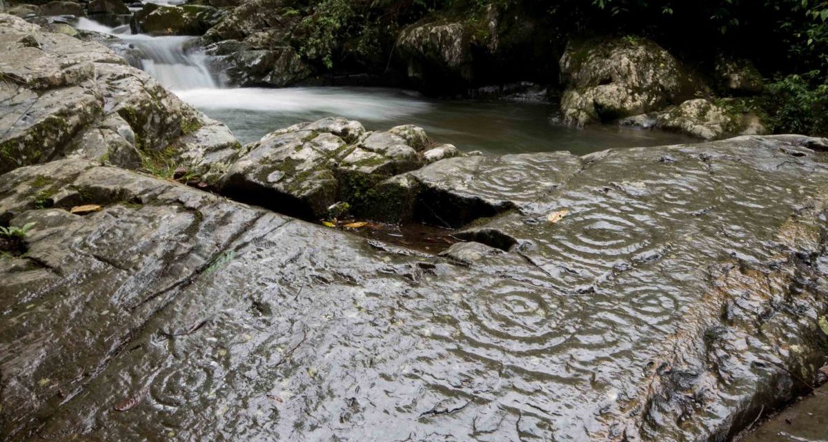
The Petroglyphs
He knew exactly where he was going, like iron filings drawn to a magnet. He called us all over to what looked like an exit from the river onto another trail. But as I stood next to him on the rock face, I could hardly believe my eyes. There, directly beneath my feet, were spiral after spiral of ancient petroglyphs.
Nacho was already bending over them, splashing water on the warm rock face. I wanted to cry out «No! Let me photograph the rock while it’s dry!»
But it was already too late. Nacho wanted to show us every detail in the surface and his experience told him that the best way to do so was to wet down the reddish-gray volcanic rock.
The water brought out rich colors of rusty orange on the smooth surface and a dark gray, green in the engraved spirals. He explained the different shapes, the spiral that signified the mother and stick figure with concentric circles for a head as the father. Of course, no one is really sure of the meanings of these petroglyphs. We can only make an educated guess as to why they are here and what they actually mean.


Nacho went to take a small rock to trace the spirals and I asked him not too. My experience with petroglyphs comes from National Parks in the United States where standing on the engraved surfaces would be an incredible desecration. And I was already doing that. To actually touch the surface of these ancient marks with a finger or even a stone is just outside of my experience. It was a level of culture shock too far.
While petroglyphs are not writing nor are they photography, I feel like the people who left these engravings would understand my desire to leave my mark. I found connection with people who lived in a different time and place.

Trail Head for Cascada Gallo de la Peña
Information For Your Trip
The trail could be very muddy in the rainy season. I do not recommend this trail in high water. Take food and water if hiking mid-week.
- Direction by Car, use WAZE and look for Parroquia Pacto, Quito, Pichincha, Ecuador (yes, this is considered the Districto Metropolitano de Quito)
- Direction by Public Transportation There are daily buses from Quito to Pacto; often the route is Quito – Pacto – Otavalo.


