First published on 14 de Noviembre de 2017 • Last updated on Noviembre 14, 2017
This page may contain affiliate links; if you purchase through them,
we may receive a small commission at no extra cost to you.
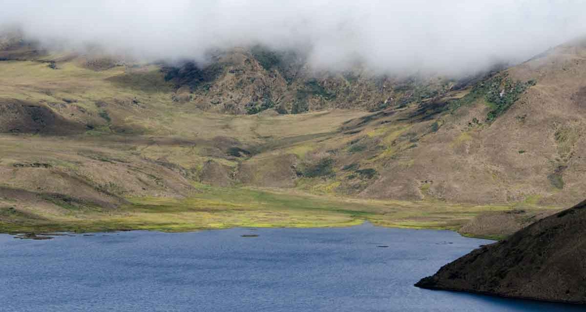
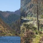
While Laguna Mica may not physically be far from the hustle and bustle of the capital city Quito, a visit to the shores of this high altitude lake transports visitors to a different world, one where white-tailed deer and Andean Condors share the high paramo with the Andean Ibis and a herd of wandering alpacas. The lake is often called Micacocha, a hybrid of the Spanish word for mica, a shiny mineral that reflects sunlight, and the Quichua word cocha, meaning body of water. Laguna Mica is best known for providing drinking water to the city of Quito.

Laguna Mica is located deep inside the Antisana Conservation Area, a protected piece of land that lies in the Napo Province of Ecuador but is accessed via the small town of Pintag, in the Pichincha Province. It is a favorite place for Ecuadorians to escape the big city and spend an afternoon enjoying the outdoors. Many arrive for the fishing – up to six trout per day per person is the legal limit. And others come to hike.

When you arrive to Laguna Mica, it is likely you will have to park in the general lot. However, if a member of your party is elderly and unable to walk a long distance or if you arrive mid-week and there are not many people around, you can ask the gaurd at the gate if you can drive further up the dirt road. Trying this on a busy weekend will only end in frustration as so many people use the road to hike.
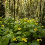
Once you have parked, cross the bridge and register at the small office by the gate. You will need a passport or cedula number. Sometimes they require each person to register; other times they require a single person to register a group, especially if they believe you are guiding a tour. After you pass the gate, take note of the set of small buildings to the righthand side of the road. They are built beside a grove of ancient Polylepis, a tree that once covered huge swathes of the Ecuadorian Andes. Today, these trees are endangered. It is difficult to see great specimens of large size without hiking for kilometers. Keep your eyes open for small rabbits and ground-loving birds.


Further up the road, you will find a trail sign. The lower trail leads to the edge of the finger lake. It does not take you around the spit of land or join with any other trail. But for kids that love to toss rocks, hikers that want to avoid gaining altitude, and lovers of waterbirds may prefer this trail.
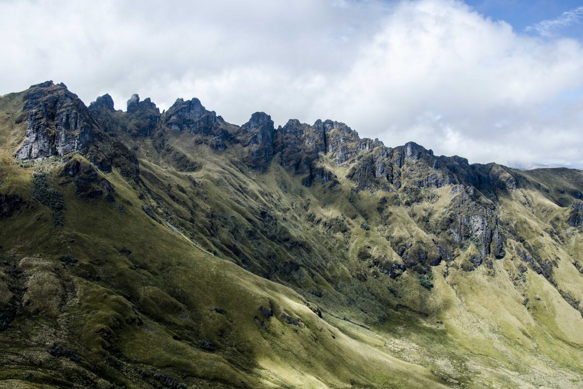
We took the upper path, to the Mirador del Condor. If you’ve been lucky on this trip, you may already have seen condors flying high overhead, especially if you stopped at the viewing platform of the Antisanilla Reserve. But there is more to see than condors… this is the trail that allows for a better view of Laguna Mica and of the huge volcano Antisana. I have yet to see Antisana from Laguna Mica in full glory. To do so, I highly recommend staying the night nearby and arriving in the early morning or late afternoon, the hours when clouds in the high Andes are most likely to clear. Even then, it’s a gamble. Even the glorious month of August, when the late summer winds scour the skies clear of cloud and fog, can be fickle in this location. Antisana stands between the weather patterns of the high Andes and the Amazon Basin and controls its own skies, seemingly at will.


The upper trail is lightly hiked, even on busy weekends. Most people stick to walking the dirt road that goes around this steep hill. But the hike up is well worth it, even on a misty, cloudy day. We’ve hiked beside the Tawny-breasted Antpitta, who doesn’t seem to mind sharing the trail. We’ve spooked bunny rabbits and White-tailed deer. We’ve caught hint of high altitude hummingbirds, seeing them buzz quickly out of sight.
If you decide to hike the high trail, give yourself plenty of time. Hiking at altitude is tough. Bring plenty of water, some high energy snacks, and all weather gear. The high mountain climate can rapidly change from a beautiful, sunny day to a misty, damp one. It is best to be prepared.
Once you reach the Mirador del Condor, you have a choice to return the way you came, or head further on. The trail eventually drops back down to the lake. From there, you can walk the road back… look for an old out building and a large stone marker to guide you. They mark the end of the road.

Reserva Antisanilla
Reserva Antisanilla - el mirador de la plataforma junto a Tambo Cóndor.
Hostería Guaytara
Hostería Guaytara
Área de Conservación Antisana
El Área de Conservación Antisana (también llamada Reserva de Vida Silvestre Antisanilla)
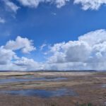
Laguna de Mica, Ecuador
Laguna Mica
Cóndor de Tambo
Recomendamos desayunar o almorzar en Tambo Condor. Este es un gran lugar para ver colibríes. También tienen un telescopio para que sea más fácil ver anidar cóndores andinos.
Información para su viaje
Si bien esta es una posible excursión de un día, no recomendamos conducir por esta carretera en la oscuridad. El amanecer y el atardecer son aproximadamente a las 6:15 am y pm durante todo el año. Dado que es probable que pierda la cobertura en estas carreteras, considere descargar una aplicación como Map.Me para mantenerlo en el camino correcto.
- Dirección en auto, use WAZE y busque Reserva Antisanilla, Quito, Pichincha, Ecuador.
- Dirección en transporte público Es posible llegar en autobús a Pintag, pero pasado ese punto, tendría que contratar a un conductor. Por favor, considere ponerse en contacto con la Fundación Jocotoco para organizar una visita guiada asequible en su lugar.


