First published on 7 de Junio de 2019 • Last updated on Junio 14, 2019
This page may contain affiliate links; if you purchase through them,
we may receive a small commission at no extra cost to you.
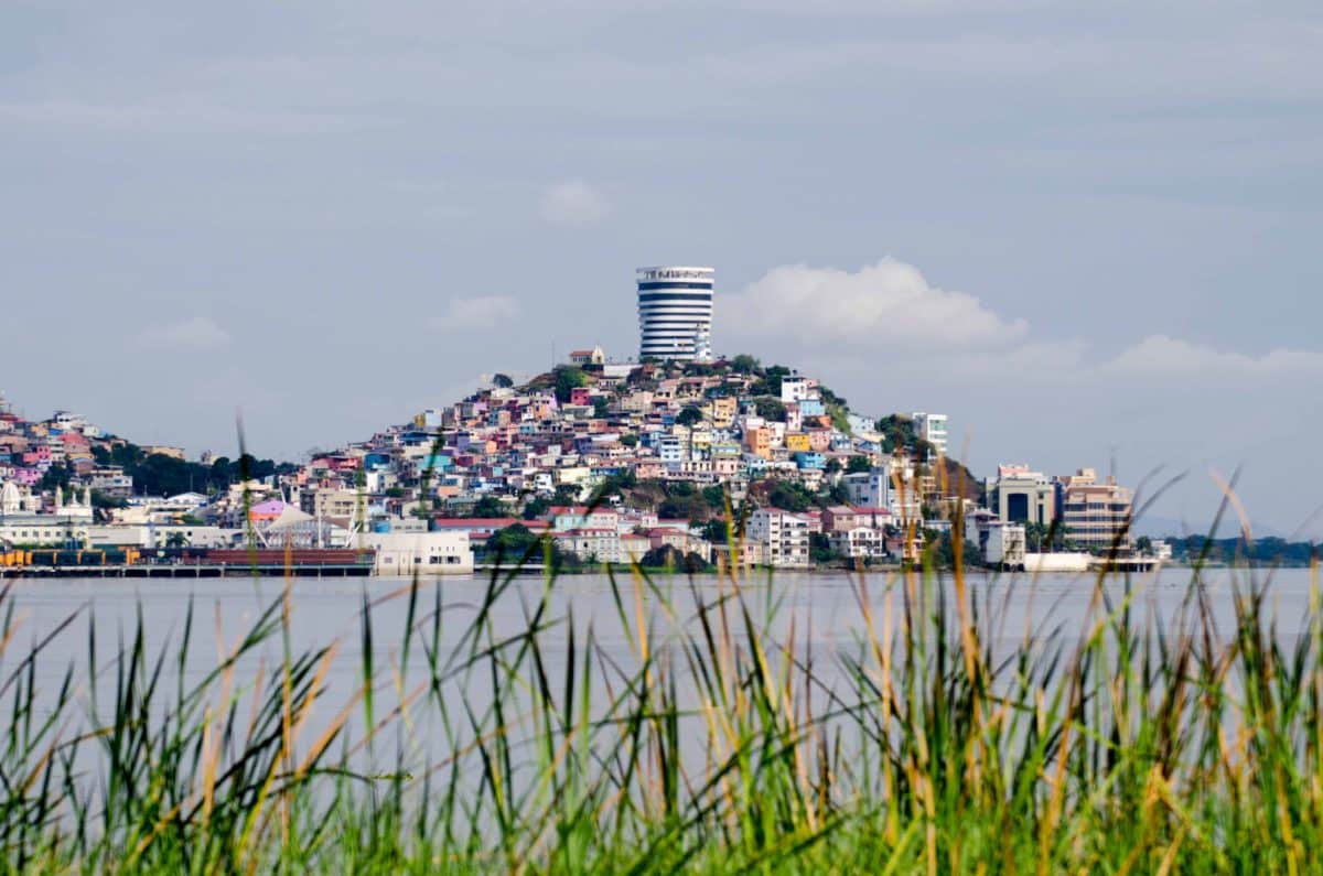
As we were waiting to get our tourist visa extension in Zamora, we ran across a great guidebook to the province of Zamora-Chinchipe. In it, we found a lot of new, interesting places to visit, including the Labyrinth of a Thousand Illusions, a hiking trail along the Nangaritza River in the southeastern corner where Ecuador meets Peru.
A Happy Surprise
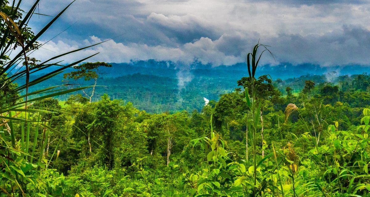
The Laberintos de Las Mil Ilusiones (Labyrinth of a Thousand Illusions) lies in a remote corner of the Zamora-Chinchipe Province. The hiking trail is a maze of volcanic leftovers from eruptions millennia ago, full of fantastic shapes that inspire many interpretations. However, the destination was way out there, at the end of one of those dotted lines (conditions subject to change, according to the map) dirt roads. We figured there was no way we’d ever make it, so we filed it for later trips and moved on to the next page.
Fast forward two weeks and we’ve arrived at Cabañas Yankuam, a little lodge on the Nuevo Paraiso road heading south along the Nangaritza River. On the wall in their open-air dining room is a ten-by-eight-foot satellite map showing the attractions in the local area. These included local birding reserves, archeology sites, indigenous cultural centers, and… the Labyrinth of a Thousand Illusions!
How Can We get there (the Labyrinth) from here (Cabañas Yankuam)?
Of course, just because it was on the map didn’t mean it was necessarily an easy place to go see. Judging from the road conditions getting to the lodge, our little rental car would have some challenges getting any further up the road.
Fortunately, the lodge manager Carlos was very familiar with the location and the road conditions. Boiled down, his he told us, “Don’t go by road, you may not get there. Take the river. I’d be happy to guide you.” All in Spanish, of course.
So, on our second day at Cabañas Yankuam, we loaded up a motor canoe and set off up the Nangaritza. The trip up and back down river has it’s own interesting story which I’ll cover in another post. For now, let’s just say we had a chance to get to know the river very well.

The Trailhead of the Labyrinth of a Thousand Illusions
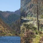
After about three hours on the river, we landed at a place that looked just like any other. There was no dock or sign that there was a trail heading up to the ridge. Carlos tied the canoe off to a tree and we climbed about a hundred feet of switchbacks only to find a road at the top of the ridge. Surprisingly, we even had to wait for a pick-up truck to pass before we could cross.
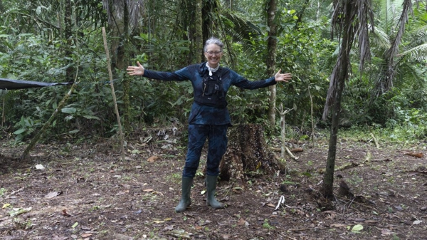
Once we crossed the road and climbed a little further up the path, we found a sign that told us we had found the right place. The owner of the property had a pretty large, two-story house at the trailhead that looked as if it may have been a hostel at one point. Now it was just a big, vacant structure with a nice covered patio we used to get arranged for the hike to the labyrinth.

The patio was a nice chance to dry off as well. January is the rainiest time of year in this part of Ecuador and there had been some impressive rain storms over the last couple of days. Fortunately, we only had to cope with showers as we came up the Nangaritza.
Trail Conditions
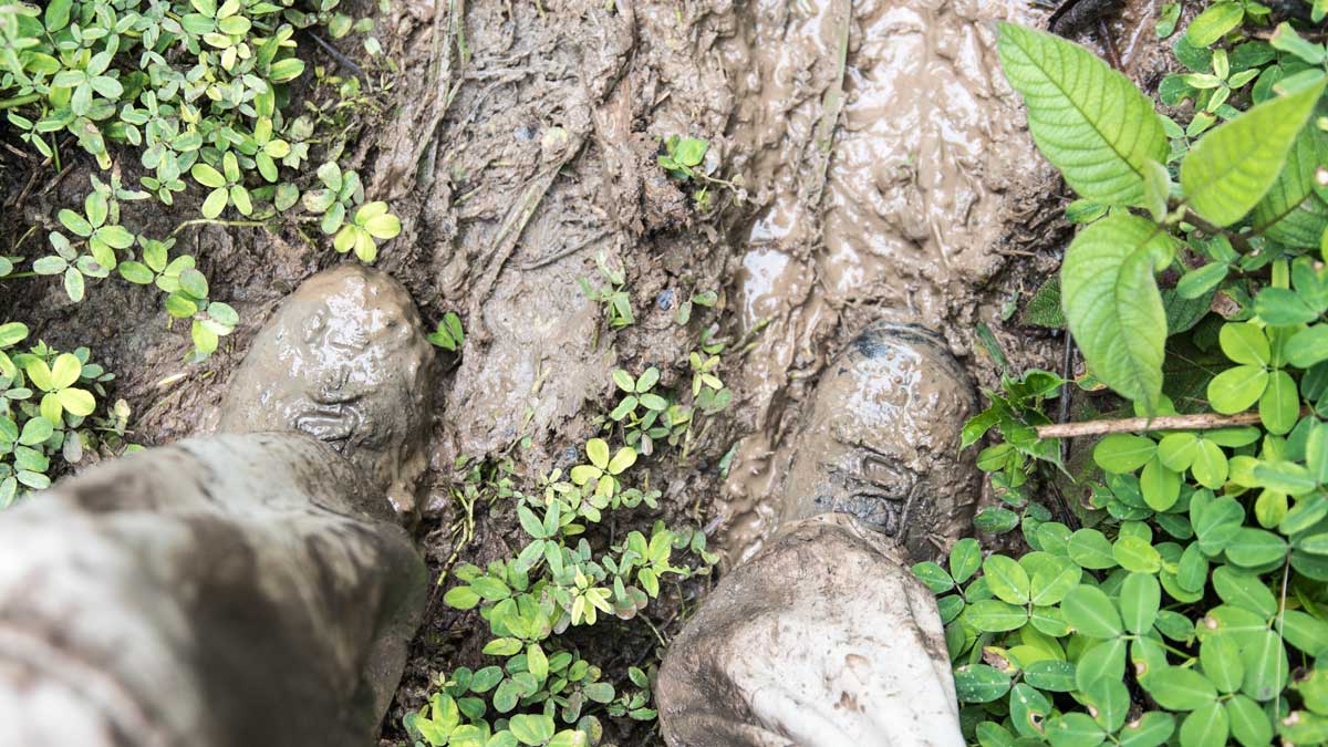
All this rain also had a big impact on trail conditions. While there were logs or branches to use as steps, the rain overran their ability to make the trail easily passable. The steep, muddy track was slippery as an ice rink in some places. In others, the mud was deep enough to suck a boot right off your feet. I rarely use a walking stick, but this time I was super happy I had grabbed one at the trailhead. It saved me from taking a tumble more than once.
After a climb of about two hundred feet thru heavy brush, the trail dried out a bit and the clouds lifted. The brief pause gave us a nice view of the river far below.

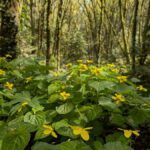
Hiking Through Forest
The next part of the trail was through mixed primary and secondary growth forest. There were some of the tallest trees and the largest ayahuasca vine I had ever seen.


Although this was a fairly well-known tourist attraction (we saw it in the tourism guide after all), the trail has seen better days. You can see from the pictures that it is easy to lose one’s bearings given the lack of landmarks in the dense vegetation. Carlos told us that using a local guide was mandatory. We could see why that was a good idea. We found out later that there were more reasons for this requirement than the condition of the trail. More on that in a moment.
After about an hour hike uphill, we reached the gateway to the maze.


A Unique Geologic Structure
I’ve been to Hawaii and other volcanic areas, but I’ve never seen terrain like this. Most lava fields are easy to see in a landscape. However, this one is hidden in the jungle. The only proof of its existence seemed to be the odd tunnels and walls. I doubt even an aerial view would give a hint at the maze that lies below the forest canopy.
What’s odd is that this labyrinth is concentrated in a very small area. It was totally unlike the terrain along the river or during most of our hike uphill. One has to wonder, why only here?

Entering the Labyrinth
After we climbed over the ridge to get into the labyrinth, the trail descended through high walls of ancient lava before leveling off thirty feet below. The sun shone thru the dense foliage far above our heads, the leaves and branches making the most interesting shadows on the uneven walls. Although the vertical walls of the channel we walked through were mostly clear of vegetation, any horizontal space was covered in brilliant green leaves or moss. The jungle was still fighting to take back this and hide it from view.

Moving deeper into the maze, the walls slowly closed over our heads and we found ourselves in a dark tunnel. Fortunately for me, this was a tall space which continued down for twenty feet or so into an open courtyard. Interestingly, in the middle of the tunnel, we saw first-hand evidence of the battle between the forest and the lava. Roots ranging in size from threads to baseball bats hung from the ceiling. The plants had actually broken thru the roof in a couple of places, letting in welcome sunlight.

Those next pictures show Angie going into a cave entrance. What you can’t see is the part right after entering the cave. You have twist around, put your gear on the ground, and get down on your belly in the mud to wiggle thru about a 16-inch tall gap in the rock before arriving to the next section of the trail. I’ve rarely been so glad I’m no taller.


The Realm of the Crab Spider
From here, we passed into the realm of the crab spider. While we love a cool spider, I have to say I was happy that these guys weren’t occupying more of the cave. There were just enough to know they owned the place, but not so many that I was worried about putting my hand on one or going face first into a web.

Re-birthing on the Trail
Carlos told us that somewhere along the trail that we’d be re-born as a part of our hiking experience. I didn’t really see that happening, but at the end of this little cave I got his meaning. In order to get out, you needed to shimmy up a rock, lay on your stomach, and then struggle thru a really small hole in the lava rock. The hole was so small my shoulders couldn’t fit thru with my arms at my side. I have to admit to more than a little trepidation as I shoved my arms up and out of the hole. I just kept reminding myself that the only other way out was to retrace our steps and figure out how to back out of the hole that had been incredibly hard to climb into. It didn’t hurt to know that Carlos was a bit bigger around the middle than me. If he could make it out, so could I. Luckily (?), Angie was there to video my struggles.
As we stood there congratulating ourselves, Carlos remarked that this was only the third time he’d come out this way. When we expressed our surprise, he said it was really easy to take a turn right after the crab spiders and climb out. But he thought we’d like it better to come out the “more interesting” way. He was right, but knowing there was another option sure would have made that last bit a little less stressful.
Dinosaur world
After our detour to the underworld, we passed into a section where we saw dinosaur feet. Huge dinosaur feet. Not that I would have recognized them as such right off the bat. I would have said they were mushrooms or umbrellas.

Guess that’s why this is called the “Labyrinth of a Thousand Illusions” and not the “Labyrinth of a Bunch of Shapes We Can Agree On.”
Just over the next rise from the largest “foot” was the end of the trail. Carlos had told us not to wander off… the sign with the skull and cross bones told us why.
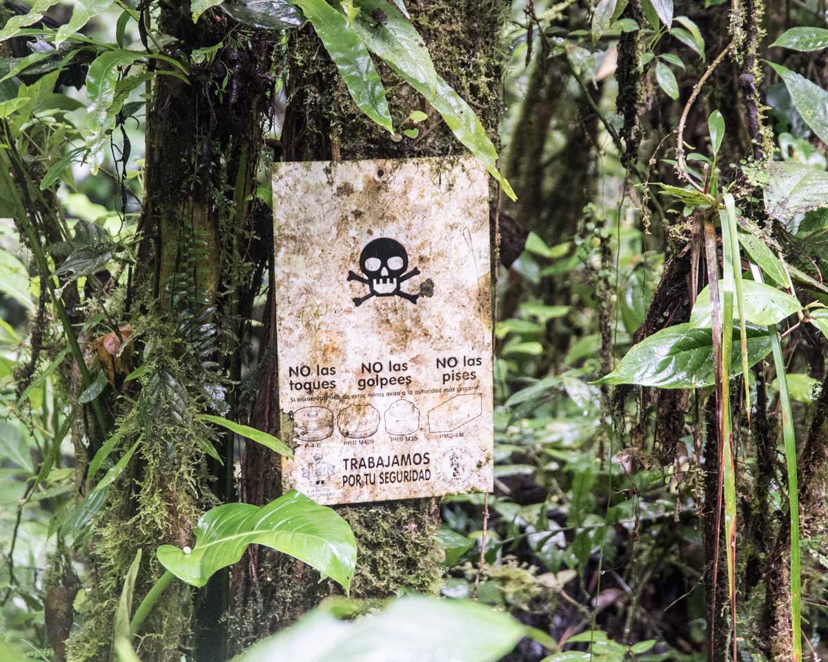
We knew this area was the site of a major conflict during the 1995 war with Peru. However, we didn’t realize this trail was quite so close to the action. Turns out, there are many hundreds of anti-personnel mines left over from the war in spite of the attempts by the United Nations, Peru and Ecuador to clear them. Having walked thru this terrain, I can’t imagine the effort required to safely remove the mines.
Following that bracing jolt of reality and reminder that local guides are important, we headed back down the trail towards the river.
I REALLY DON’T LIKE MUD
It’s an open question for me whether a muddy trail is easier to climb or to descend. For all the problems we had on the way up, on the way down the mud seemed deeper, the grassy parts slicker, and every branch I grabbed to stop from falling had thorns. Therefore, in this case, it was easier to climb up the muddy trail than to slide down it.
At least it wasn’t raining as we slowly worked our way down the ridge. The deluge waited until we were back at the trail head. It was rain as only seen in the jungle… sheets of it. We were sitting under a corrugated steel roof when it started. We had to stop talking because of the noise.
After about 20 minutes, we decided it wasn’t going to stop any time soon, so we headed back to the canoe. The trail down to the river was a creek itself and the pretty little waterfall near where the boat was tied up was now milk chocolate brown from the hillside runoff. This was going to be an interesting ride down river. For that story, you’ll have to wait for another day.


